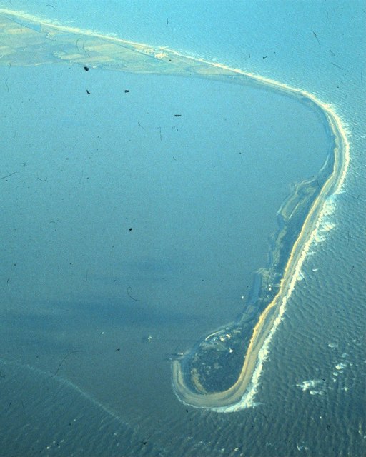
Lying at the foot of the Humber Estuary, the majesty of this windswept spit of land has constantly changed due to storms, the sea and mankind. Caught between The North Sea and the Humber Estuary, Spurn Point has had settlements, a military base, lifeboat community, and nowadays a nature reserve. It has also captured the imagination of poets, writers, has featured in a Shakespeare plays and even had its own railway and school. In modern times Spurn has become more and more at the mercy of the sea, such as in 2013 when a tidal surge nearly split the peninsula in two.
Geography
The Spurn peninsula is around 3.5 miles long and was formed 10,000 years ago after the retreat of ice from the last Ice Age. Lying at the bottom of one of the world’s fastest eroding coastlines, the formation of Spurn point is the result of a geographical process known as longshore drift. Silt, stones and pebbles are washed down by the sea from further up the coast by sea currents in a diagonal movement caused by gravity. Eventually the material is deposited at the bottom of the coastline, forming a large, narrow spit of land. The rapid erosion of the material on Spurn causes the original peninsula to be washed away and another forming slightly to the West, in a cycle that lasts approximately 250 years. This process has been reported to have happened three times since The Norman Conquest.
Lost Settlements at Spurn
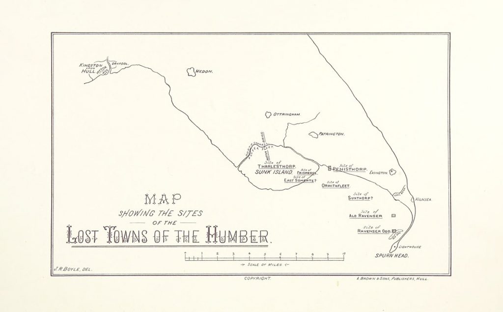
In Medieval times, Spurn was once home to two settlements, Ravenser Odd and Ravenspurn. The former was a port, founded in the mid-thirteenth century. By 1299 it had a market, around 100 houses and had become an even more important port than nearby Hull. However, during the winter of 1356-7, a great storm ravaged the town, resulting in flooding and its eventual abandonment. Another great storm in January 1362, known as ‘The Great Mandrenke’ finished the job and submerged Ravenser Odd forever into the sea. Its neighbour, Ravenspur faired a little better and was even mentioned in three Shakespeare plays, most notably when Henry Bolingbrooke landed here on his way to depose Richard II as king. Ravenspurn lasted until the 19th Century before falling victim to the tides.
Military Use
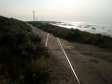
Due to its strategic location on the East coast pointing towards the continent, it is inevitable that Spurn has been used as a form of military defence. In 1805, during the Napoleoni cWars, a gun battery and barracks were established here. In the First World War, the point and the nearby village of Kilnsea were home to 500 troops at its garrison. German Zeppleins could also be seen flying over Spurn on their way to bomb Hull. The military railway, which connected Kilnsea and the end of Spurn Point was opened in 1915 and parts of the track beds can still be seen today. In 1925, Spurn was bought by the War Office on a compulsory purchase order from the landowners, The Constables, from Burton Constable Hall. During the Second World War, the headland was also put to military use once again, with several gun batteries being added to its existing armouries and garrison. In 1951, the military railway closed, to be replaced by a road which went to the lighthouse and lifeboat station at the end of Spurn Point. By the end of the Fifties, Spurn Point had been completely de-militarised. Most of the military buildings and associated features were demolished in the 1970s, although some features, such as searchlight emplacements, two gun batteries and two forts can still be seen on the peninsula to this day. In 2018 archaeologists discovered a warren of tunnels which were part of the military base. On the walls they found drawings and graffiti done by the soldiers which date back to the First World War. The excavations are ongoing at the time of writing.
Spurn’s Lighthouses
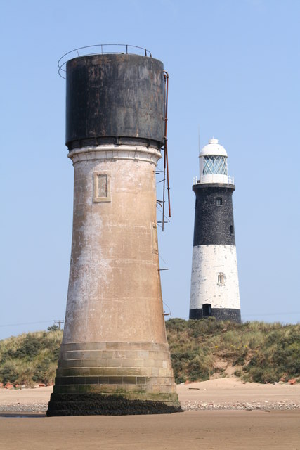
There have been references to lighthouses at Spurn Point from as far back as 1427 and records from the 16th Century suggest there were two. The civil engineer, John Smeaton was commissioned to build a pair of new lighthouses at Spurn in 1767. The lighthouse which housed the lowlight was washed into the sea not long after and so a series of temporary replacements were built, until a more permanent lowlight was constructed in 1852 by Henry Norris. Then in 1895, a single all-encompassing lighthouse was built at Spurn, which is the one still standing today. It is 39m high and was painted black and white.
The lighthouse was in full operation until 1985, when it was decommissioned, due to advances in navigational technology and stood empty until 2013, when it was bought by the Yorkshire Wildlife Trust. Since 2016 it has been open to the public as part of the ‘Spurn Safari’ attraction, which allows visitors to climb to the top of the lighthouse and admire the amazing views of the sea and estuary.
Lifeboat Community
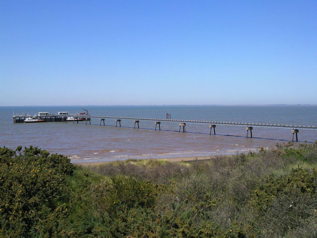
Alongside the lighthouse, the lifeboat station has been operational at Spurn since as far back as 1810. In 1819 the cottages were built to house the lifeboat workers and their families and in 1890 a school was built for the children, which lasted until 1945. The crews are one of the few fully paid professionals in the UK and were originally under the jurisdiction of Hull Trinity House, a seafaring charity. In 1911 they became part of the RNLI and changed their name to the Humber Lifeboat. Apparently when the military railway was operational on the peninsula, the residents of the lifeboat community adapted a boat so they could travel down the railway tracks, often in the opposite direction to the soldiers so they could get to the mainland and back more quickly. The original cottages were replaced by more modern accommodation in 1975. In 2012, due to problems with erosion and bad weather, the decision was taken to move the six lifeboat families out of the permanent accommodation on Spurn Point. Furthermore, a going to the shop was a 16 mile round trip, which was becoming increasingly more dangerous, especially in winter. The Humber lifeboats are still fully manned and continue to save many lives at sea. The crews work on a shift pattern and divide their time between living in the accommodation and at residencies on the mainland. Over the past 210 years, the Spurn lifeboat station has saved countless lives and achieved 33 medals for gallantry.
Nature Reserve& Tourist Attraction
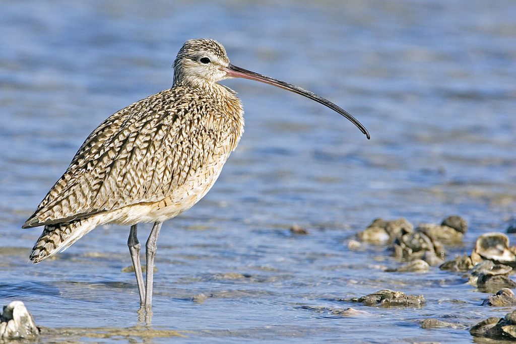
The location of Spurn on the East Coast and the high and low tides of the peninsula makes it an important place for migrating birds. Often, summer or winter visitors to the UK will congregate in large numbers at Spurn before flying to their breeding or wintering grounds throughout the country. Furthermore, migrating birds, who are blown off course by bad weather end up visiting Spurn by mistake, before flying on to their intended destination. This all makes for an exciting place to watch and record the movement of birds. The importance of Spurn was first recognised in the 19th Century and visited by the top ornithologists of the day. Just after the end of the Second World War an observatory was established here, where bird, insect and animal recording has continued here ever since. After the de-militarisation of Spurn in 1959 it was bought by what is now known as The Yorkshire Wildlife Trust to continue the good work of the earlier naturalists. In 1996 Spurn was recognised as a National Nature Reserve and it is also a place of Special Scientific Interest. In 2015 further tourist facilities were added, such as a new Visitor Centre, the restored lighthouse and the ‘Spurn Safari’ tours which take in the peninsula’s heritage, wildlife and views of ‘Yorkshire’s Land’s End.’
Tidal Surge of 2013 and the Future of Spurn Point
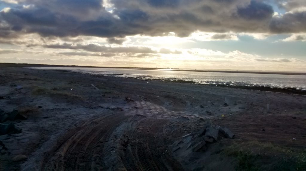
On the night of the 5th December 2013, Spurn Point was hit by a great storm which caused a tidal surge from the Humber to The Wash. Some of the sea levels in the North Sea were the highest on record. The surge on Spurn caused a lot of damage and nearly split the peninsula in two. Most notably it ripped out the road to Spurn Point in just one hour. This meant that the lighthouse and lifeboat station at the very tip of Spurn Point were isolated. A further consequence is that during high tide Spurn Point is cut off from the mainland at high tide. Therefore anyone attempting the three mile walk from the car park at Kilnsea must check the tide times before setting off. An emergency shelter has also been built for people who have the misfortune to be cut off during high tide.
This new configuration of Spurn has now paved the way for the ‘Spurn Safari’ attraction which takes tourists down to the end of the point in a converted 4×4 ‘Unidong’ vehicle and to the newly refurbished lighthouse.
The development of the new Visitor Centre, which had 2,800 objections during its planning stages, the refurbished lighthouse and Safari trips since the tidal surge has seen Spurn Point develop into a modern tourist attraction. While this means that more people are able to take in the wonders of Spurn and learn about its amazing history and ecology, there are concerns by locals that the environmental consequences of more people, cars, dogs and litter could have a detrimental effect on the wildlife and tranquillity of this wonderful natural wonder of Yorkshire.
Regardless of this, the future of Spurn Point in a time of climate change and rising sea levels will only be determined it seems by Mother Nature herself.
Have a look at our Yorkshire T-shirts below:

Written Sources
https://www.skeals.co.uk/spurn.html
http://www.yorkshireguides.com/spurn_point.html
http://www.geography.learnontheinternet.co.uk/topics/spurn.html
https://en.wikipedia.org/wiki/Ravenspurn
https://www.bbc.co.uk/news/uk-england-humber-42823514
https://www.pastscape.org.uk/hob.aspx?hob_id=916014
https://www.skeals.co.uk/people.html
http://www.birdersmarket.com/acatalog/Spurn_Head.html
https://www.yorkshirepost.co.uk/whats-on/arts-and-entertainment/point-no-return-1788616
